
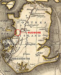
Though only the faintest shadow of it's former self in the 21C, Rudmore was once inhabited by a number of long established Portsmouth families, many of whom were involved in work on the sea and in the harbour. It was ideally situated for such endeavours being on the west side of Portsea Island, adjacent to the harbour and to some extent shielded from the weather by Whale Island.
 PORTSMOUTH 1791
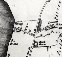 RUDMORE AREA 1823
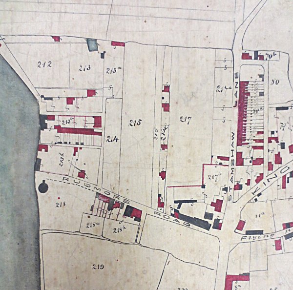
 RUDMORE AREA c1845
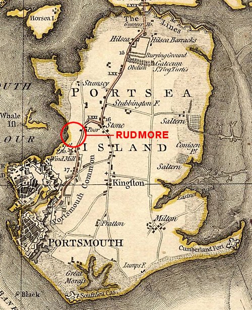
The first families probably didn't migrate to the area until the first decades of the 19th century. Before that, according to Alexander Howell in 'Topography of Portsmouth', published in 1913, Rudmore was known as "Rydmore or Rydmer [which] was near West Street Green, towards the harbour. There was a pond here formerly called Rydmore Pond, and the land still called Rudmore Lane was the ancient road to the Dockyard along the shore." [See the map of 1791 (right)]
By 1823 (see map, right) Rudmore was beginning to establish an identity. It was by then occupying the area around Rudmore Road, north to the open land at Stamshaw and west of Stamshaw Lane. Industry, in the form of three mills, was beginning to creep north from Portsea, whilst a workhouse had been established on Commercial Road to the east and the first hints of urbanisation were being seen in the angle between Stamshaw Lane and Kingston Crescent. Meanwhile, a scattering of buildings had appeared at Rudmore.
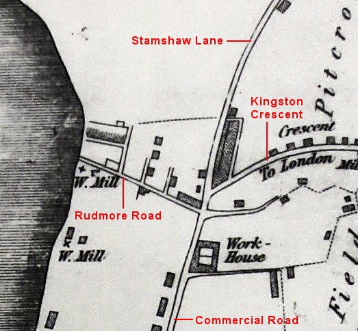
The Tithe Map created by Thomas Ellis Owen between 1838 and 1845 (see map right) shows that Rudmore was becoming noticeably more populated. The Schedule to the map lists the field numbers shown on the map with the relevant owners and occupiers and from this it is apparent that the centre of Rudmore together with some of the surrounding fields (212 - 214) was owned by 'The Widow Winsom' who owned no other plot of land on Portsea Island. This woman was Ann the widow of James Winsom who died in 1841, at which time they were living at Purbrook Common. Ann moved to a house in Rudmore later in the 1840s.
At the 1841 census there were 46 households recorded living in Rudmore and as the contemporary map shows 36 residences, some of them were plainly sub-divided. The occupations of the inhabitants reflect the proximity to the sea and the working class nature of the area. There were 20 households where the head was connected directly to the sea either as fisherman (12) or seamen (8) but there were also 15 tradespeople, some of whom would also have a maritime element to their employment such as shipwrights (5) and blacksmiths (3). It is noticeable that the census lists a block of 12 households in which 11 are fishermen/mariners and that the the map shows a row of 12 or 13 cottages in Plot 213 which would appear as Rudmore Place on later maps. This must have represented a tight community especially as three households were occupied by the New family.
By the early 1860s the urbanisation that was creeping across most of Portsea Island took a lasting grip on Rudmore with Simpson Road having been drived west from the junction between Stamshaw Lane and Twyford Avenue and Sea View forging north from Rudmore Road. The 20C notion of Rudmore was by then largely defined.
Tim Backhouse
March 2013
References
Hampshire Telegraph